Back to Webinars
This webinar presents an AI-driven approach to time-series Interferometric Synthetic Aperture Radar (InSAR) for monitoring and understanding Earth surface deformation and supporting geohazard assessment. It will provide an overview of the principles of InSAR and multi-temporal analysis, including the extraction and interpretation of deformation patterns from satellite radar observations over time.
The webinar will explore how Artificial Intelligence and Machine Learning can be integrated with InSAR time-series techniques to improve the detection, characterization, classification, and prioritization of deformation signals and anomalous areas. Particular attention will be given to AI-based approaches for identifying persistent and emerging deformation hotspots, distinguishing significant deformation patterns from noise and measurement uncertainties, and transforming large-scale satellite observations into actionable information.
Practical examples will be presented to demonstrate the potential of combining Sentinel-1 SAR data, time-series InSAR processing, and AI techniques for monitoring phenomena such as land subsidence, ground instability, landslides, and other geohazard-related deformation processes. The webinar will also discuss challenges related to temporal variability, atmospheric effects, spatial and temporal resolution, data quality, and the generalization of AI models across different geographic and environmental conditions.
Finally, the webinar will highlight the potential of AI-driven InSAR as a scalable Earth Observation framework for continuous deformation monitoring, early detection of abnormal surface movements, geohazard assessment, and the development of intelligent early-warning and decision-support systems.
Login to Register
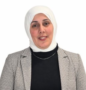
Dr. Hind Zeyada Abdel Hamid Ebrahim
AI & Satellite Remote Sensing Research Scientist at National Authority for Remote Sensing and Space Sciences (NARSS)
Dr. Hind Zeyada Abdel Hamid Ebrahim is an AI and Satellite Remote Sensing Research Scientist at the National Authority for Remote Sensing and Space Sciences (NARSS), Egypt. She holds a PhD in Computer and Systems Engineering, with a specialization in Artificial Intelligence and SAR Remote Sensing. Her research focuses on AI-driven Earth Observation, Synthetic Aperture Radar (SAR), time-series InSAR, Earth surface deformation monitoring, and geohazard assessment. She has extensive experience in developing deep learning and AI approaches for satellite imagery analysis, including SAR-based oil spill detection and monitoring, as well as Sentinel-2-based water body mapping and monitoring. Her research also covers environmental monitoring, land cover analysis, and the development of intelligent Earth Observation solutions. She is actively involved in academic teaching, scientific research, and the supervision of AI and remote sensing projects.